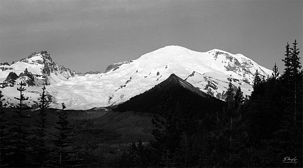
This was one of my earlier attempts (around 1986) at applying the Zone System to 35mm. My wife and I and our 8 month old daughter (who is now 28) spent the weekend hiking and camping on Rainier. I got up about an hour before sunrise (it was about 25º out) and hiked to this area, which I had scoped out the day before. I set the F2 on a tripod with my 105mm f/2.5 and started taking meter readings with the 1º spot meter. As the sun started to come up I continuously tweaked the exposure. I wanted the foreground to be primarily Zone IV with the trees dropping to Zone III. It was very important for me to preserve detail in the foreground. As the sun came up on the snow I realized I could not maintain detail in the foreground without blowing out details in the snow, which I wanted to be Zone VII and VIII. At that point I decided to use N-2 development with the Plus-X I was using to preserve details in both. The image below is a 14 bit, super fine scan with the LS-800. I have not done any post processing apart from cropping and removing a few dust spots from the sky. Although the Zone System was designed to be used with sheet film, it can be adapted to 35mm. This film was hand loaded into reusable cassettes, so after the shot, I rewound it and marked "N-2" on the outside of the cassette. I used Microdol-X undiluted at 68º for the developer.
The "pulled" development did accentuate the grain a little, only really noticeable in the sky, but it is just part of the
photographic process.
The truly unique thing about Mt Rainier is that when viewed from all 4 points of the compass, the mountain (which is over 14,400 feet high) looks completely different! For instance, this image was taken facing west, the one I posted the other day was looking south, only a 90º difference. It looks like two entirely different mountains. Contrast this with Mt Hood in Oregon (not my image, just from the web), which is a near perfect cone and looks pretty much the same from all directions
I would have loved to be able to do this with Mt St. Helens, but even 6 years after the eruption, much of it was still inaccessible.

Last edited:

